
Ireland has some of the best wild places in Europe, so get out and explore it. Here are 51 of the best walking routes around, to help you do just that!
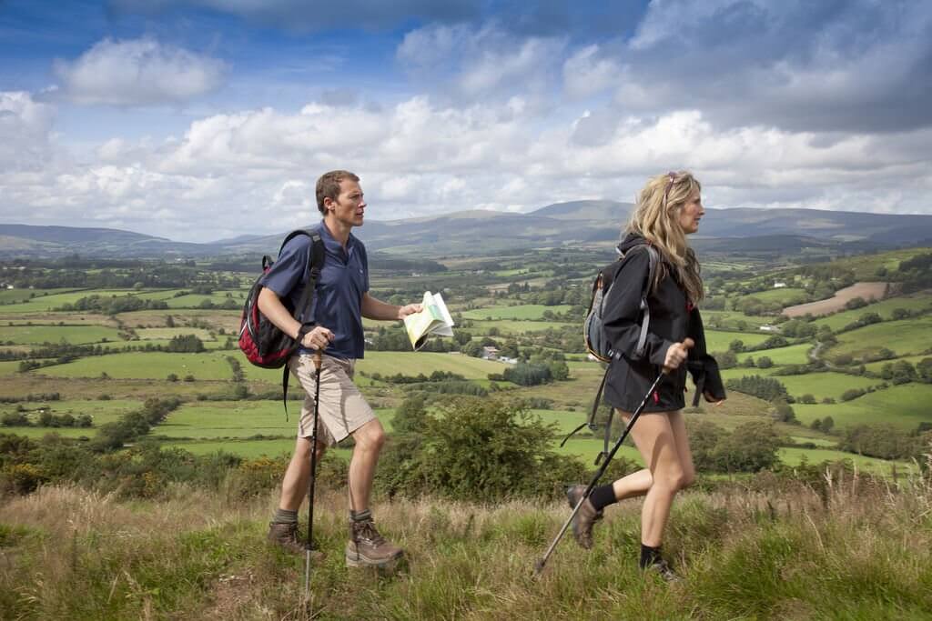
From the peaks of Wicklow county to the rugged scenery of Connemara, walking is a great way to explore the beauty of Ireland. The backdrop is always stunning and there’s a great sense of satisfaction when you reach the summit and get to appreciate the full beauty of the countryside from a height. The majority of the routes chosen below can be done in a day and are suitable for most people with a reasonable level of fitness. If you want to tackle some of the longer routes then you can break it up into sections and walk the route over the course of a few weeks or months. We’ve even spearated them out into the fours provinces for your convience. Enjoy!
THE BEST HIKES IN LEINSTER
Wicklow
1. The Lugnaquilla Mountain from Glenmalure Loop Walk
Distance: 15km
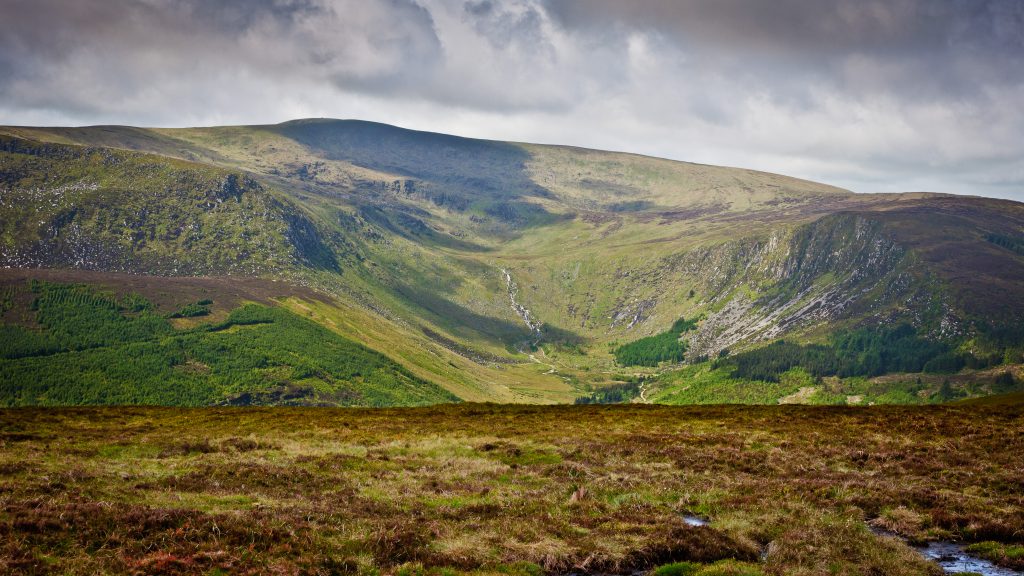
This is a bit of a strenuous one, taking in two peaks. But don’t let that deter you the views are worth the strain! A six-hour walking route to the summit of the ever popular Lugnaquilla Mountain (925m) from Glenamalure and returning via Cloghernagh (800m). The views en route are pretty mindblowing, taking in the Wicklow Mountains, the Glen of Imaal, Glendalough and Glenmalure.
2. Bray to Greystones cliff walk
Distance: 7km
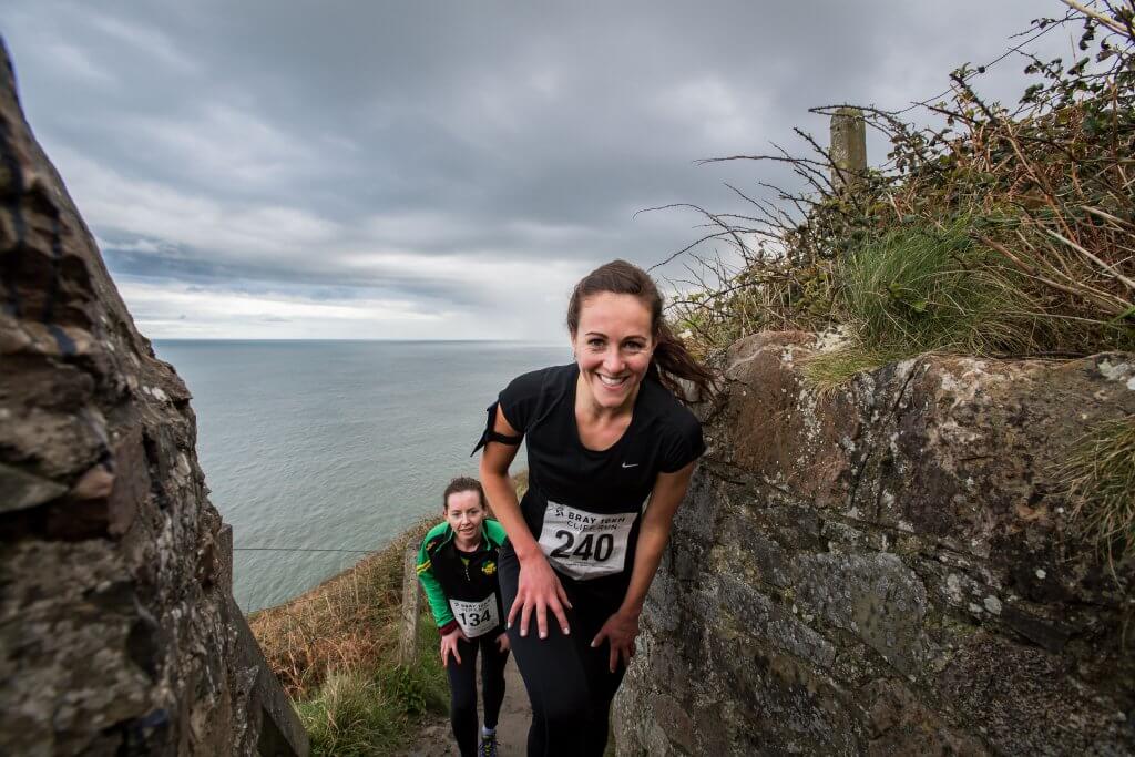
This cliffside walk has become somewhat of a favourite in recent years. Hop on the DART and head to Bray or Greystones to walk this coastal path that connects these two beautiful little towns. Walk the well-worn track and gaze out at the blue waters to try and spot some marine life. You can also climb to the top of Bray Head if you want an even better view along the east coast. An alternative and fun way of doing this particular route is as part of Gaelforce’s Bray 10km cliff run!
3. The Avonmore Way
Distance: 12km
The Avonmore Way is a relatively new trail along the beautiful Avonmore river in Co. Wicklow. Take a stroll through the wooded valley, starting at Trooperstown Forest. Follow the waymarked trail through the forest under the cover of spruces and emerge out at the hamlet of Clara Vale. This 12km route will take you three to four hours to complete.
4. The Wicklow Way
Distance: 127km
The Wicklow Way was one of the first long-distance hiking trails in Ireland and it still remains the most popular one in the country. Don’t let that deter you though, if you are seeking solitude, you’ll still find it here. Bar around Glendalough, chances are you won’t meet too many kindred spirits walking. The waymarked trails include mountains, upland lakes, steep-sided glacial valleys, fast flowing mountain streams, forests and farmland. Beginning in Dublin’s southern suburb of Rathfarnham and travelling down through Wicklow to finish in the picturesque village of Clonegal, Co Carlow.
Check out more of our favourite Wicklow walks here.
Dublin
5. Howth Cliff Walk
Distance: 12kms for the full loop
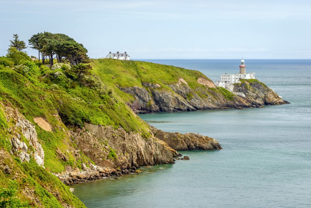
This little slice of heaven is located a short journey from the city centre but offers the perfect opportunity to get some fresh air and a bit of exercise. Oh, and the views out over Dublin Bay, the Wicklow Mountains, Ireland’s Eye and Lambay are pretty epic too! There is an abundance of fantastic restaurants and cafes in Howth to finish off what is always a great day or evening out! The starting point is Howth DART station or just beyond Sutton Dinghy Club. This walk is suitable for beginners and all levels of fitness.
Check out our other walks for beginners here.
6. Ticknock
Distance: 5.5km

Ticknock offers a great network of mountain and forest walks just a stone’s throw away from Dublin. Nestled in the hills just beyond Sandyford in south Dublin, you can drive to Ticknock from the city centre in around half an hour but the walk will make you feel like you’re lost in the wilderness.
There are around 10km of walking trails through forests and mountains with incredible views of the greater Dublin area from the top of Three Rock Mountain. You can do an out and back if you don’t want to go too far, or there are plenty of loop walks in this area like the Fairy Castle Loop which is 5.5kms.
For more info on Ticknock walks click here.
7. Malahide to Portmarnock Coastal Walk
Distance: 4km
This is a very easy 4km coastal path between Malahide and Portmarnock on the northside of Dublin city. It’s tar sealed and wide so can accommodate buggies and kids on bikes. The coastal route passes the lovely Malahide Village and marina, the beach and rocky shoreline, Lambay Island and brings you around to the Velvet Strand and Ireland’s Eye Island at the Portmarnock end.
There are plenty of other options if you want to add on to your walk, by exploring Malahide Castle and Demesne or there’s the Robswall Park Hillside Hike at the end of Malahide beach if you want to cross the road and head up the hill for a better view.
Check out more of our favourite Dublin walks.
Carlow/Kilkenny
8. The Barrow Way
Distance: 120km
This four-day walk along the River Barrow is still somewhat of a hidden gem for anyone but the locals. The Barrow Way follows surviving towpaths and riverside roads, from Lowtown in Co Kildare to the idyllic little village of St Mullins in Co Carlow. The peaceful route winds its way through the sylvan landscape following the river. You’ll find accommodation in one of the many quaint villages dotted along the grassy tracks of the Barrow Way.
Wexford
9. Mt Leinster
Height: 793m
Standing on the summit of Mt. Leinster, you will revel in the biting winds, beautiful views of the patchwork green fields of the valley below and the semi-wild horses and sheep grazing on its pastures. The mountain overlooks the three counties of Carlow, Wexford and Wicklow and there are plenty of walks to choose from.
The Blackstairs Challenge walk is a 30km undertaking that traverses the entire range. But perhaps the most accessible option is to drive to the gap at the Nine Stones and to make the 6km round trip to the summit via the access road. Although be warned, the nine stones themselves are very unimpressive! There are also some great mountain bike trails in the forestry carved by the local club Racing795 if you are so inclined.
Check out our full review of Mt Leinster for more information.
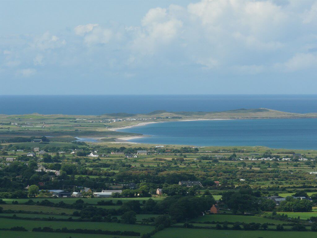
10. Raven’s Point Wood
Distance: 6.8km
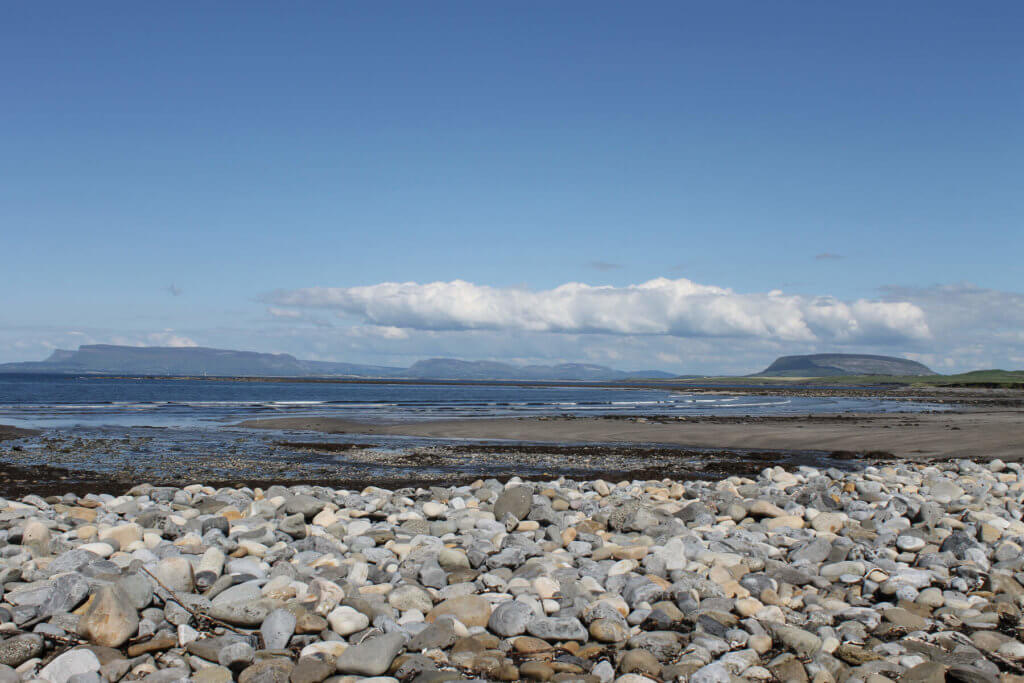
Park up at the Raven Wood car park and explore the beautiful woodland walkway before emerging out onto the stunning white sandy beach. The fields to the west are the North Slob lands, home to many important species of birds. If you are doing this walk during the winter months, you might spot all the geese from the North Slob flying out to roost on sandbanks in Wexford Harbour. The beautiful blue flag beach at Curracloe is definitely the highlight of this beach walk.
More info: Wexford Walking Trails
11. Tintern
Distance: 0.9km – 7.2 km
There are four incredible walks in Tintern, all of varying distances and difficulties. Gardener’s Trail (.9km) starts at Tintern Abbey and explores the architecture and the mixed woodland. This trail is suitable for buggies and wheelchair users. The Tintern Demesne Trail (2.4km) is one for nature lovers. You’ll discover fine beech, oak, and chestnut trees and hopefully spot some kingfishers, egrets, buzzards, red squirrels, stoats and seven type of bat.
Bannow Bay Trail (7.2 km) is for the history buffs. It takes in the old estate village of Saltmills, an old IRA memorial, a rare double lime kiln and a grounded dredger. Finally, there is Foxboro Trail (3.5 km) for the fit. This woodland trail along the Tintern river includes some great climbs.
Check out our full list of Wexford walks here.
THE BEST HIKES IN MUNSTER
Waterford
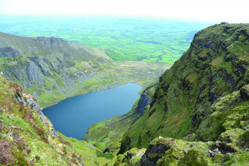
12. The Coumshingaun Loop
Distance: 7.5km
This loop around the beautiful Coumshingaun corrie lake and the surrounding mountains will make your jaw drop. It’ll take you about four hours. Park up at Kilclooney bridge and begin the gentle ascent up the mountain. Take in the steely blue of the lake and the beauty of the surrounding area. There is also some great rock climbing and ice climbing spots in the area.
13. Red Loop, Glenshelane
Distance: 2km -10km
Outside Cappoquin there is an idyllic little forest with a picnic site, car park, the Glenshelane River and trees galore. The Glenshelane forest walks consist of one linear and three looped walks. The blue route is 2km long, the green is 3km, the red is 10km and the purple is 2.75km. The extensive network of forest roads, trails and bridges means you can while away the hours exploring the very best of nature. Look out for red squirrel and mink plus there is a noted salmon spawning area upstream.
14. The Comeraghs
Distance: 6km
The Comeragh Mountains are a magical mountain range. Lying side by side with their sister range the Monavullagh Mountains. So many peaks to play amongst; from Coumshingaun to Crotty’s Lough to the Gap, you’re spoilt for choice. One of our favourite routes up it is a good 18km hike, but it really has the best views. The name Comeraghs comes from the Irish for ‘abundant in hollows and streams’ and with about 15 corries and countless streams, they live up to their name. The high mountain plateau above is truly a world apart and quite a change from the steep approach.
Check out our full review of the Comeragh Mtns for more information.
Clare
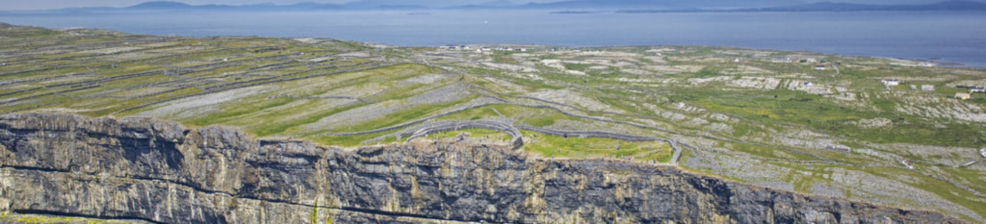
15. The Burren Way
Distance: 114km
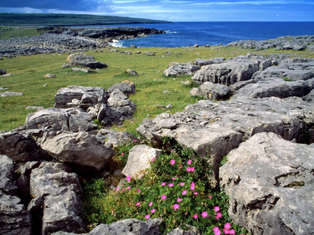
The Burren is well known for its unusual landscape. And what better way to experience the limestone pavements than on foot. Winding its way from Lahinch to Corrofin, the karst landscape of bedrock makes for a piercing contrast to the deep emerald green of the Atlantic swell below. It will take around five days to make your way around the quiet tarmac roads, forest paths, tracks and up a few of the sweat-inducing climbs.
A Complete Guide to the Best Irish Walks
16. Cliffs of Moher Coastal Walk
Distance: 5km each way (or you can go all the way from Liscannor to Doolin – 18kms – 4 hours 30 mins)
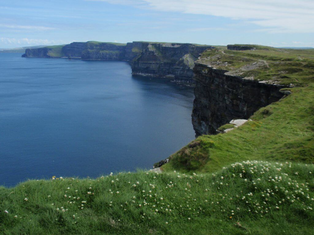
There is no steep climb or hard work required to benefit from the incredible views on offer on this route. Those without a head for heights might struggle at a couple of points as the walkway is quite exposed, but fear not it is well set back from the edge! This is a walk best done on a clear day so you can take full advantage of the views. The starting point is Hag’s Head or at the Interpretive Centre.
Those wanting to do a guided walk should get in touch with local man Pat Sweeney who does a pick-up at O’Connor’s Pub in Doolin. If you fancy doing the walk just one way, there is a shuttle bus which runs between Doolin and Liscannor.
17. Kilkee Cliff Walk
Distance: 8km
The Pollock holes, Diamond Rocks, and Intrinsic Bay are just some of the delightful hotspots you’ll encounter on the Kilkee cliff walk. It starts at the Diamond Rocks Café at the West End of the town of Kilkee. With no walls between the walkway and the cliff’s edge, you’ll get your daily dose of adrenaline just by walking. Away from the crowds, Co Clare’s Kilkee cliff walk is a delight waiting to be discovered.
18. The Lough Avalla Farm Loop
Distance: 8km
This is the perfect walk to experience the beauty of the Burren National Park. The trail is easy but has a few challenging spots, so allow two to three hours to complete it. Meander through the classic Burren limestone pavement and note the fascinating geological features. At a height, you’ll be treated to views of Mullaghmore. Keep an eye out for the delightful details left my a local farmer along the way. A stash of handmade hazel walking sticks for visitors to use and drop back. Handmade hazel gates and stiles, and two glass mugs from a hazel tree to allow walkers to drink from the well. It’s rumoured to cure diabetes!
Check out our full review of the Lough Avalla Loop.
For more walks in Co Clare, check this out.
Limerick
19. The Ballyhoura Way
Distance: 90km
This 4-day hike stretches over three different counties; Cork, Limerick and Tipperary and is 90 km long. The total estimated climb is also 1560 metres, so for this one, some fitness and experience is required. Ballyhoura Way is a lovely trail with a lot of variety that is marked out well. There are some accommodation options throughout the route in the frequent enough villages, but not too many.
The highest point is 477 metres at Castle Phillip, which is reached over moorland. The trail includes views over the Golden Vale, Glen of Aherlow and the Galtee Mountains. A heads up is that almost half of this route follows public roads and although they are mostly quiet, local, ones – always keep an eye on potential cars. You’ll start off the hike in Kilkenny, at St Johns Bridge and finish up in Limerick, at the station car park.
More info: Irish Trails
Check out our full list of Limerick hikes here.
Kerry
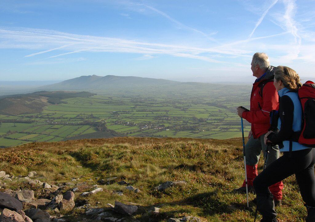
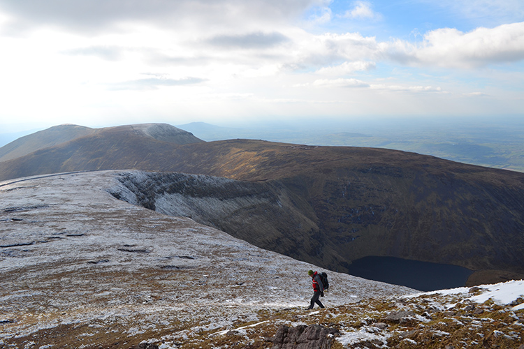
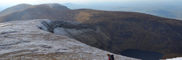
20. Carrauntoohil
Height: 1,039m

And to save the best until last, our highest peak by a good bit, Carrauntoohil. It’s the mountain that should be on every Irish person’s bucket list. Even if solely for the bragging rights to say you’ve climbed the highest peak in the country. Set among the beautiful Macgillycuddy Reeks in Co Kerry, the Reeks has 27 individual peaks. They cover an area of around 100 square kilometres from the Gap of Dunloe in the east to Glencar in the west. It will take about 5-7 hours to make the return trip, covering a distance of 12-13 km return. It’s for fairly hardcore hikers so don’t rock up in a pair of jeans and a leather jacket!
Check out our full review of Carrauntoohil for more information.
21. Cronin’s Yard Loop
Distance: Beaufort – 12km, Killarney – 22km
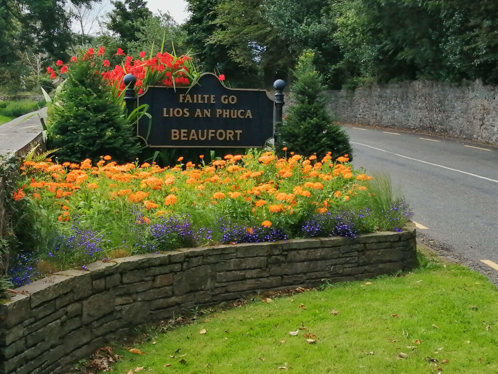
The Cronin’s Yard Loop will take you across sandy paths and up through mountain tracks. Starting from the trailhead at the exit from Cronin’s Yard, just follow the purple arrow. You’ll walk along the Caol River, the Gaddach River and Lough Callee. Cronin’s Yard is the gateway to the MacGillycuddy’s Reeks and an ideal base from which to explore the surrounding countryside. Plus, you can get your packed lunch before you head off and a hot shower afterwards.
22. The Kerry Way
Distance: 215 km
Kerry is already well known on the international stage for its rural beauty. And the Kerry Way is no exception, it is stunning. Boasting views across emerald green fields and out on to the crashing Atlantic ocean. There are few better places in the world. The 215 km route starts and finishes in the vibrant town of Killarney. The trek through the Iveragh Peninsula can take roughly 7-10 days to complete. Camp or stay in one of the many fine establishments dotted along its entirety.
23. The Dingle Way
Distance: 179km
This looped walk begins and ends in the thriving town of Tralee, Co Kerry. Over the eight to nine days it will take to walk it, you’ll experience the foothills of Slieve Mish, the crashing waves of the Atlantic at Slea Head and golden beaches on the Maharess. Aswell as an abundance of Irish history, from standing stones, ogham stones and a multitude of beehive huts. Plus the oratory of Gallarus!
Check out our full list of walks in Co Kerry.
Cork
24. Old Head of Kinsale Loop Walk
Distance: 6km
This is a beautiful and easy walk, perfect for a winter’s afternoon. The Old Head is a stunning headline jutting out into the Atlantic Ocean, so get excited for the panoramic views of the cliffs and ocean you will see throughout the walk. Look out for the Old Head Lighthouse built in the 17th century and the remains of the Lusitania passenger ship, which was torpedoed by a German U-Boat during WW2.
25. The Sheep’s Head Way
Distance: 88km
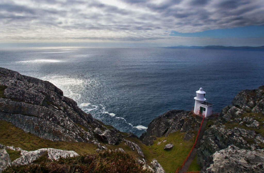
The lighthouse marks the southern tip of Bantry Bay, and a 2km trail walk leads to the lighthouse with beautiful views of the peninsula. Because of it’s distance from the road, much of the equipment and materials used in the construction of the lighthouse were airlifted by helicopter. The lighthouse comprises a 7 metre high round tower on a square building. The Lantern is 83 meters above sea level. The lighthouse is maned by a part time attendant, who carries out essential maintenance.Photo:Valerie O’Sullivan
There is no better view of the Atlantic than from the protruding Sheep’s Head peninsula. You won’t have time to dwell on your tired legs because your eyes will be so glued to the landscape. Watch out for an old copper mine, a blowhole, stone circles, standing stones, sheer cliffs, a Napoleonic signal tower and old churches. Down in the sea, you are also likely to spot dolphins and whales if you are lucky enough!
26. Ballycotton Cliff Walk
Distance: 13km
View this post on Instagram
This Cork coastal walk is a must do. Passing through green farmlands to the beautiful Ballyandreen beach. It’ll take roughly four hours to walk this well-worn cliff path. Warning, there are many stiles to cross, just in case you were tempted to bike it or bring a buggy, don’t!
27. Dursey Island, Beara Peninsula
Distance: 14km loop around the island, or you can do an out and back if you want.
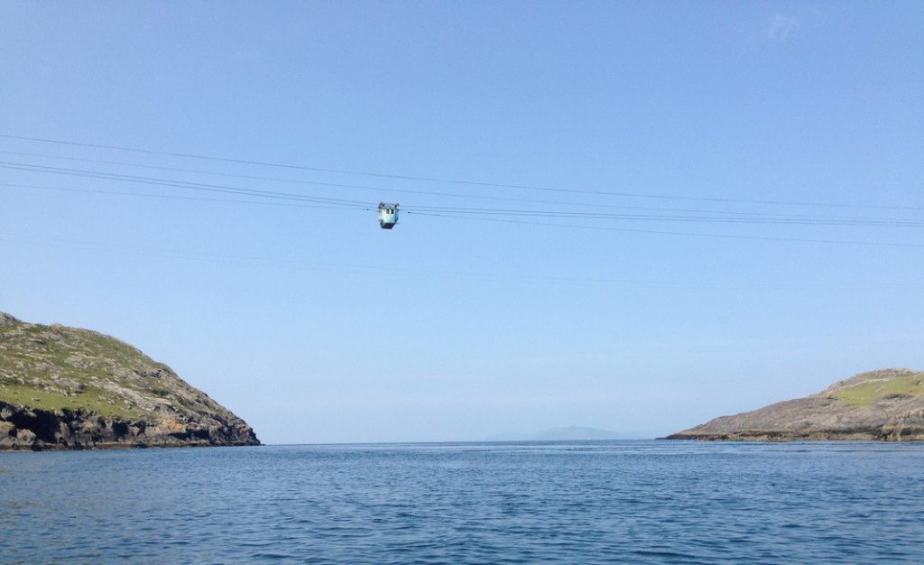
Dursey Island is home Ireland’s only cable car. Carrying just six people at a time, you are likely to share the car with dogs and a couple of sheep too. There is also holy water and a Psalm on hand too, just in case!! The island itself is home to a dramatic coastline which has been shaped by the mighty Atlantic below. You will walk along the cliffs and across boglands and fields over the course of the hike. There are no shops, pubs or restaurants on the island so it’s like going back in time, completely peaceful and tranquil (just don’t forget your sambos and flask of tea!). There is wildlife in abundance and those lucky enough might spot whales or even basking sharks as well as an array of birdlife.
28. The Beara Way
Distance: 184km
The Beara Way is a long distance walking route around the stunning Cork peninsula. This particular trail is a good one for all you history buffs out there, with a large concentration of historical and archaeological sites en route. It passes through the towns of Castletownbere, Kenmare and Glengarriff. It is also fully signposted.
Check out our full list of walks in Cork here.
Tipperary
29. The Galtees
Height: 919m
Explore Ireland’s greatest inland mountain range, the Galtees. Stretching over 20km from Mitchelstown to Caher they offer a myriad of hiking options with fantastic views. At 919m, Galtymore is Ireland’s only inland Munro so there’s plenty of climbing in this walk. One of our favourite hikes is a 5.5hrs one that covers a distance of 13km. Starting at the secluded car park at Galty Castle Wood, running along the Attychraan River, up the Black Road and finally summiting at Galtymore.
Check out our full review of the Galtee Mtns for more information.
THE BEST HIKES IN CONNACHT
Mayo
30. Croagh Patrick
Height: 764m
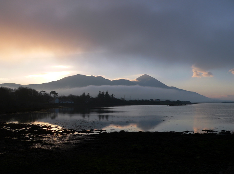
Sitting just outside Westport is Croagh Patrick, arguably our most well-known peak. Made famous by our patron saint St. Patrick for fasting on the top of the mountain for 40 days and 40 nights. It’s a tough drag up the side of the conical tower over uneven rocks and loose scree. But you will be rewarded with incredible panoramic views of the hundreds of tiny drumlin islands in Clew Bay and the very best of the Wild Atlantic Way. Catch your breath at mass in the gem of a church that sits on the summit.
The hike will take about three or four hours to get up and back down, on what is a 14km round trip. You don’t need to know how to navigate just follow the people, which is ironically the only downfall of this climb, during the high season it’s busy!
Check out our full review of Croagh Patrick for more information.
Wild Camping Spots in Ireland: 15 of the Best
31. The Nephin Begs
Distance: 40km
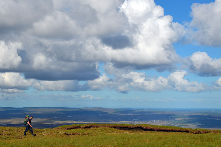
The Nephin traverse is a big undertaking over rough ground requiring good fitness and the ability to navigate. But, man, is it worth it! I think we’ve all heard the call of the wild at some stage, but sometimes it’s not that easy to really get that wilderness feel from a place. You will here, with over 11,000 hectares of pristine Irish real estate in the Nephin Beg Range of north-west Mayo’s Ballycroy National Park. It was designated Ireland’s first wilderness area. In this traverse you’ll cross Knocklettercuss (370m), Maumykelly (364m), Slieve Carr (721m), Nephin Beg (617m), Glennamong (628m), Corranabinnia (714m) and Ben Gorm (582m).
Check out our full guide to the Nephin Begs here.
32. Annagh Bay
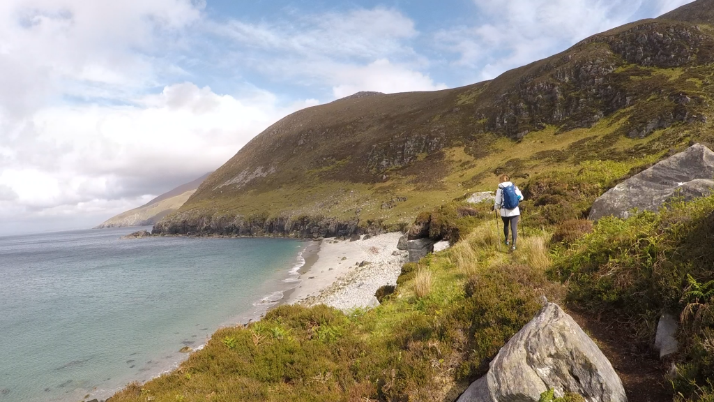
Living in Ireland we are fairly accustomed to wow moments. After all, our scenery is some of the best in the world. However, nothing will quite prepare you for what lays ahead on this Achill Island venture. From the moment you leave the car at Lough Acorrymore, to the moment you return some four hours later, you will be in utter awe of your surroundings. Lough Acorrymore a geographical feat in itself – high cliffs surround a glassy lake, green hills rolling up and up to one side and views out across the sea behind.
For our full guide to Annagh Bay click here.
33. The Bangor Trail
Distance:
The Bangor Trail in Mayo is one of Ireland’s last true stretches of wilderness. An ancient route through the Nephin Beg hills of northwest Mayo, the trail was once used to bring livestock across this desolate landscape. It is 200 square miles of no roads or houses. This is a real adventure.
Check out our full review of the Bangor trail here.
For more Mayo walks, take a look here.
Galway
34. Knockma Forest Walk
Distance: 4 km
This scenic looped walk is in Tuam, County Galway. At just 4km long, it is a short spin but steep in parts. The view at the top of the climb is something special to behold. The walk takes place on a rough path through the wooded area, which is made up of oak, ash, hazel and other broadleaf trees. It is a part of the country that is very much connected with our history, with some stunning neolithic cairns on top. Two of which are rumoured to be the burial places of Queen Maebh of Connacht and of Finnbhearra, King of the Connacht fairies.
35. Portumna Forest Park
Distance: 10km
Portumna Forest Park covers almost 450 hectares of which the majority is dominated by coniferous woodland. It is a nature nerds paradise with ash, beech and silver birch dotted along the lakeside. Yew and juniper also appear. Animal species in the area include red squirrel, fallow deer, foxes, badgers and a white tailed sea eagle who nests there. There are four walking trails of varying distances in Portumna Forest Park. One is the Rinmaher Walking Trail, a long singletrack loop with great views along the lakeshore.
36. Omey Island Loop
Distance: 8km
Largely abandoned in winter and with a smattering of summer visitors, Omey island in Claddaghduff, Cleggan, is a gorgeous spot to explore on foot. This is an easy but really special walk as you’ll head off across a sandy causeway that is exposed when the tide is low. So be sure to check the tide times so you can get back and be prepared for plenty of water and tidal puddles on the route!
You’ll leave from Sweeney’s pub on the mainland and head left along the road before taking a right at the chapel to head to the shore to cross the sands following the marker posts. Follow the island road and after a mile, you’ll go over the low brow of hill. Now take the sandy track on your right and follow it left around sandy bay (keep your eyes open for the Tobair Feichín holy well. Then head back to Fahy Lough and keep left following the track beside it, keeping the fence on your right. Keep going till you reach the north shore and head right to the causeway and back to Claddaghduff. The walk takes two to three hours.
For more walks in Galway click here.
Sligo
37. Benbulbin and Kings Mountain Loop Walk
Distance: 8km

This loop will take you three to four hours. Climb to the plateau of Kings Mountain which is steeped in Irish mythology and thought to be Fionn mac Cumhaill’s table. Then on to the cliffs at Benbulbin Head (526m). Experience the home of Yeats in all its glory. No wonder he was inspired to write such brilliant prose, with views like this on his doorstep.
38. Knocknarea, Queen Maeve Trail
Distance: 2.4 km
This walk is filled with beautiful views out over Strandhill, Sligo, Leitrim and Donegal with Benbulbin in the distance. The walk is also steeped in history – the summit is crowned by the great cairn of Queen Maeve, which is 5,000 years old (3400 BC), and is thought to have a network of passage tombs. It used to be a sacred burial site and you’re asked not to climb on the cairn out of respect. Queen Maeve of Connacht is said to be buried there – buried upright with a spear in her hand still facing her enemies in Ulster.
39. The Dunmoran/Aughris Coastal Walk
Distance: 8km
For a route that’s a little off the beaten track, Sligo’s Dunmoran/Aughris coastal walk is ideal. Follow Dunmoran Strand along the limestone cliffs to Aughris Head. You’ll be confronted with isolation, blasting sea air, rushing tide and quiet serenity for the afternoon. The views of Benbulben and Knocknarea are simply spectacular. Plus, you’ll discover a haven of seabird colonies including gulls, oystercatchers, divers and gannets en route.
Check out our full review of the Dunmoran/Aughris coastal walk.
THE BEST HIKES IN ULSTER
Down
40. Slieve Donard
Distance: 9.2km
Slieve Donard is Northern Ireland’s highest peak and stands at 850m. It is part of the enchanting Mourne Mountain range. A 9.2km round trip from car park to summit and back will take you anywhere between four to five hours. Follow the well-defined trail that takes you up the hill along the Glen River through a rich forest of pine, birch and oak. When you reach the top, you will be greeted with views of the Mourne Mountains stretching out like a rich tapestry all around you.
In good weather, you will also spot the Isle of Man in the Irish Sea, the Wicklow Mountains to the south, and the peaks of Wales, Scotland and even Donegal to the west. A little closer, you will see Newcastle Beach with a strand that’s 2.5kms long.
Check out our full review of Slieve Donard for more information.
41. Slievenaslat Walk, Castlewellan Forest Park
Distance: 4.5km
This forest walk has a bit of a steep climb to it, but this means you can peak between the trees for some superb panoramic views of the Mourne Mountains and surrounding drumlin landscape. Just follow the yellow waymarkers. This is one of the more difficult trails as it is rocky in places and has some tricky steps up to the summit, which stands at 272 metres. There is also three waterfalls to be spotted in the park and a visitor centre, shop and restaurant.
42. Tollymore Forest Park, Newcastle
Distance: 9km
The Mountain Trail in Tollymore Forest Park is a stunning forest walk in Northern Ireland through forest plots and a beech woodland that runs alongside the Shimna River. Superb views of Luke’s mountain can be had as the trail reaches the boundary wall. To make your walk longer, add on the Drinn’s trail for a bit more of a challenge, which takes in the highest point in the Forest Park at 255m. The Curraghard viewpoint has a viewing spot to sit, catch your breath and feast your eyes on views of the Northern Mournes, Dundrum Bay, Newcastle and the Irish Sea.
For more information on Irish walks, check out The Ireland Walking Guide.
Cavan
43. Deerpark Forest Walk
Distance: 5.5km
The Virginia Slí na Sláinte is a 5.5km circular route. Located at Deerpark Forest, just outside Virginia, Co Cavan, the route follows beautiful tree-lined paths through the forest and passed Virginia Golf Club, taking in the banks of Lough Ramor. The full route will take about an hour and a half to walk and can be walked in both directions.
Donegal
44. Errigal Mountain and Mackoght Loop Trail
Distance: 6km
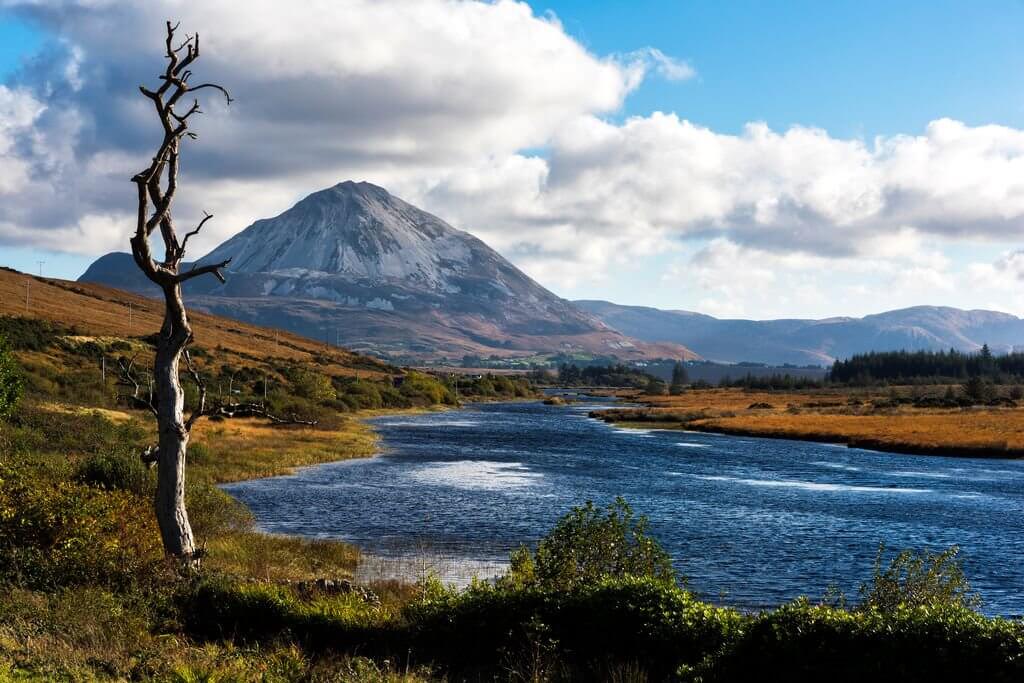
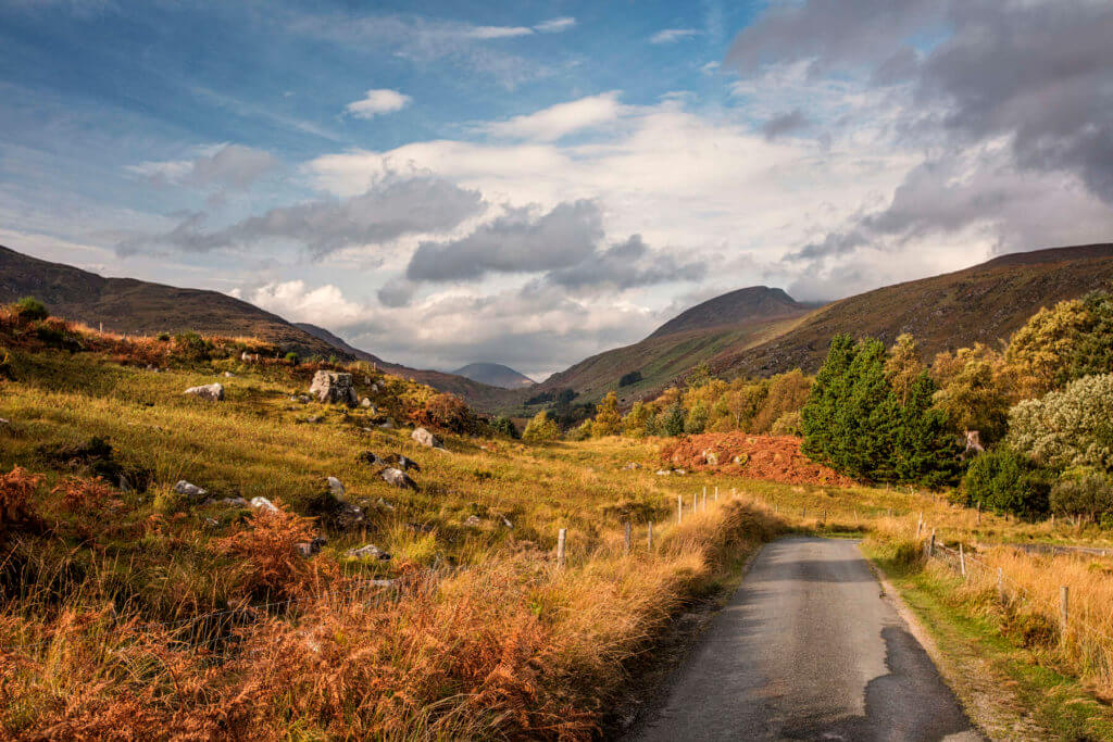
This 3.5hrs hike is considered to be a moderate to strenuous trail and is known for its iconic peak at the top of Errigal Mountain. You’ll experience a tough but brilliant 751m climb to the summit of Donegal’s highest mountain, with views over nearby Dunlewy Lough and Glenveagh National Park.
45. The Pilgrims Path, Sliabh League Cliffs
Distance: 2-12km
While the masses gather at the Cliffs of Moher, let us let you in on a little secret, the sea cliffs of Slieve League are actually three times the height. Make your way up the narrow One Man’s Path and peer over the edge. There is no better place in the world than standing on the edge of a cliff, with seabirds flying overhead and nothing but roaring swell beneath you. Make sure to look out for two rocks nicknamed the ‘giant’s desk and chair.’ There are plenty of routes to choose from 2km to 12km options and carparks to leave your car. Our favourite route is the Pilgrims Path.
46. Muckish Mountain
Height: 666m

Muckish Mountain is a stunning tabletop mountain to rival Benbulben in Co Sligo. Its steep sides and wide plateaued summit give it its name An Mhucais, the pig’s back. There is a choice of routes to the summit, one on the Falcarragh at Gleannaneor, and the other main route is called the Miners Path. If you’re after remoteness and some tranquillity then this is the ideal climb. When you get to the top, enjoy the views of Derryveagh, Creeslough, North Derry and Antrim.
For more walks in Donegal, check this out.
Antrim
47. Glenariff Forest Park
Distance: 9.5km
Glenariff is considered the Queen of the Glens of Antrim. Its walkway has two small rivers the Inver and the Glenariff which contain incredible waterfalls, pools and steep-sided gorges. The trail first takes you down the Inver River gorge, nearly to the Ess-na-Crub Waterfall. Then up a long and winding kilometre climb. There are great views of the Glens and of the Mull of Kintyre across the sea from the top. And on your way back, you are greeted with more stunning vistas of the Glen to the coast and the sea beyond. There are facilities on site too.
48. The Causeway Coastal Route (from Ballintoy to Portbalintrae)
Distance: 16km
Another of Ireland’s natural wonders is the Giant’s Causeway. The best way to experience it in all its splendour is by approaching it from the crest of a hill. Starting out at the secluded harbour at Ballintoy (Game of Thrones location!), you’ll head to the golden stretch of White Park beach and then onto the mighty cliffs of Benbane Head. Finally, you’ll head down to the octagonal rocks where the myths and geology collide, before pushing on to Portbalintrae.
Check out our full review of The Causeway Coastal Route (from Ballintoy to Portbalintrae).
49. The Ulster Way
Distance: 1000km
This one’s a long one, a whopping 1000km long! But if you want to really explore Northern Ireland then there are few better ways to do it than by foot. The route takes in the Mourne Mountains, the Antrim coast and the Sperrin Mountains, so there’ll be a few climbs. The walk will take around three weeks and takes place mostly on quiet roads, forest tracks or trails. However, inevitably on a distance of this scale there will be some busy roads.
50. The International Appalachian Trail Ulster Ireland
The International Appalachian Trail (IAT) Ulster–Ireland starts from the magnificent sea cliffs at Slieve League and stretches 449km all the way to Larne in Co Antrim. The trail was launched in 2013 and goes through some of the most stunning locations that Donegal and Northern Ireland have to offer. Lovers of short and long walks, of geology and history, of flora and fauna will all find something that will forever cement the IAT Ulster–Ireland as one of the standout walking trails in the country.
Check out our full guide to the IAT Ulster Ireland.
51. The Wild Atlantic Way
At 2,500 km long, the Wild Atlantic Way is your ultimate long distance walk. Many have driven it, a few have cycled but how many can say they walked the entire Wild Atlantic Way? The increasingly popular tourist trail on the west coast of Ireland passes through nine counties and three provinces. Stretching from Co Donegal’s Inishowen Peninsula to Kinsale, Co Cork. There are 157 discovery points, 1,000 attractions and more than 2,500 activities and is well worth taking a look if your feet are up for it!
Or else there is the more manageable Coast to Coast at 595km. Stretching from Marley Park in Dublin all the way to Bray Head on Valencia Island, Co Kerry, this is one of Ireland’s toughest long distance walks. It links up some of the great Irish trails including the Wicklow Way, South Leinster Way, the Munster Way, the Blackwater Way and the Kerry Way.
Check out our Hard as Nails podcast:
Like this? Check these out:


Great list, and some new ideas for walks/runs I’d like to try. Ulster’s North Down Coastal Path probably merits an inclusion too. M.
This is a great list and although I really couldn’t argue with any of the rankings and inclusions I’m both surprised and disappointed not to see the gorgeous Cooley peninsula mentioned. Surely these hills on the border with Armagh and Down are worth a mention! This is where my passion for hillwalking started and you can not be disappointed with the variety and landscapes this peninsula offers.
This guide is fantastic! I can’t wait to explore some of these routes, especially the ones in Kerry and Connemara. The photos are stunning and really inspire adventure. Thanks for sharing such comprehensive details!
What an incredible list! I’m excited to explore these hiking routes and experience the beauty of Ireland firsthand. The diversity in landscapes and trails you’ve highlighted is so inspiring. Can’t wait to plan my next adventure!
This post is fantastic! I love how you’ve highlighted so many beautiful walking and hiking routes across Ireland. Each description makes me want to lace up my boots and hit the trails. Can’t wait to try some of these out on my next adventure! Thanks for the inspiration!