The International Appalachian Trail Ulster-Ireland starts from the beautiful Slieve League cliffs in Donegal and finishes up in Larne, Co Antrim. This cross-border trail is 449km (279 miles). The trail is relatively unknown among the Irish, but after reading this article, you’ll be in no doubt about wanting to visit one of the most diverse and epic walking trails in Ireland.
What is the International Appalachian Trail Ulster-Ireland
The International Appalachian Trail (IAT) Ulster–Ireland starts from the magnificent sea cliffs at Slieve League and stretches 449km all the way to Larne in Co Antrim. The trail was launched in 2013 and goes through some of the most stunning locations that Donegal and Northern Ireland have to offer. Lovers of short and long walks, of geology and history, of flora and fauna will all find something that will forever cement the IAT Ulster–Ireland as one of the standout walking trails in the country.
The trail, which is Ireland’s only official coast to coast walk, can be tackled in either direction and walkers can dip in to enjoy short sections of trail which feature points of interest, or, in keeping with the Appalachian theme, attempt longer sections – or even the entirety of the trail, and savour the challenge of traversing some of the country’s most amazing landscapes.
There has been significant investment in trail, including trail furniture, artwork installations, improved facilities and updated information panels. The trail has also developed its own social media channels for followers to get a taste of the IAT Ulster–Ireland experience, including a popular section on their Instagram page known as “Tales from the Trails” which looks at short facts or snippets of history about different sections of the trails.
Find out more: IAT Ulster-Ireland
IAT Ulster-Ireland: The Sections
The IAT Ulster-Ireland has been broken down into smaller, more manageable sections. We’ve got tonnes of information here to help you choose which section you’re going to tackle first and you’ll find more information at IAT Ulster-Ireland.
Section 1: Bunglas to Glenties
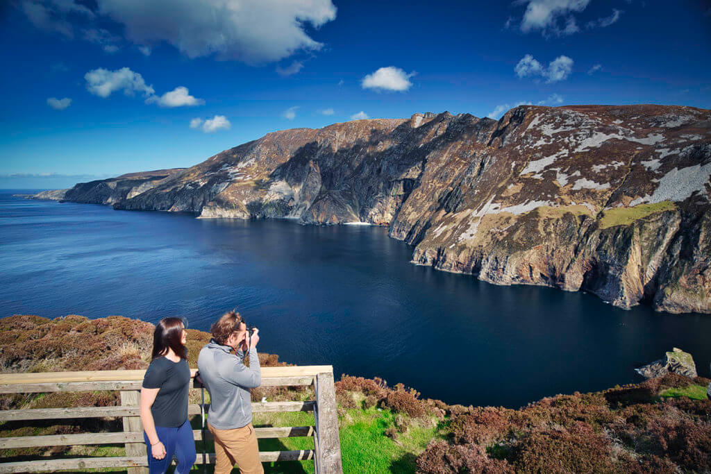
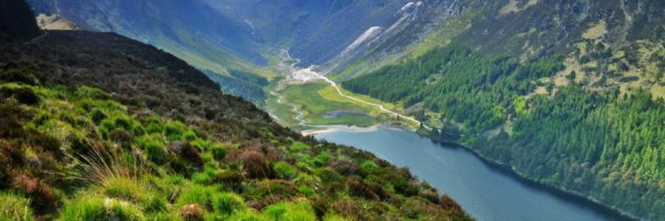
This section starts on the beautiful Wild Atlantic Way at the Slieve League cliffs in Co Donegal. The route takes you through Glencolmcille to Ardara, and ends at Glenties. This section incorporates part of the Bluestack Way between Ardara and Glenties.
Distance: 68km (42 miles)
Difficulty: Hard. This section of the IAT Ulster–Ireland trail is one of the hardest. It involves many steep climbs, boggy and rocky trails, and difficult descents. Parts of the trail are along quiet roads. The mountainous sections can be very difficult. However, the views are worth the intensity. Donegal is beautiful.
Points of interest:
- Slieve League Cliffs: These are amongst Europe’s highest sea cliffs and offer breathtaking views.
- The Sturrall: Although relatively unknown, the Sturrall is one of Ireland’s most beautiful sea cliff features. It’s a seriously impressive headland and is offers a very exposed 400m mountain ridge scramble.
- Caves of Maghera: You’ll find 20 caves, eight arches and five tunnels here. They are accessible by kayak or another small craft. However, you must be wary of changing tides and currents, and always exercise caution when exploring.
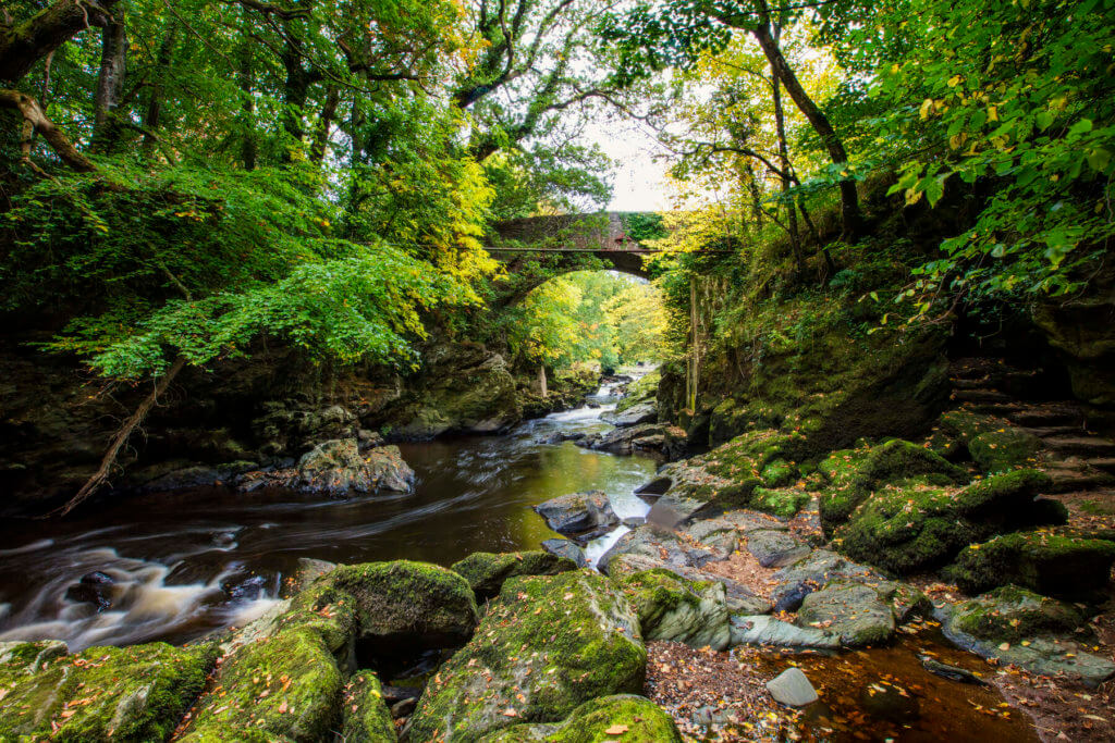
- Assaranca Waterfall: This is considered one of Ireland’s most beautiful waterfalls and is very easily accessible. It’s the perfect spot to visit after a long day hiking.
Places to stay:
- Aras Ghleann Cholm Cille Hostel in Malinmore. This hostel will provide shuttles to and from places along the trail.
- The Nesbitt Arms Hotel in Ardra is affordable and there is a relaxing pub with good food in the hotel.
- Marguerite’s B&B in Glenties is the perfect cosy stop-off before you start the next section of the trail.
- Brennan’s B&B in Glenties is the ideal stay if you’re looking for a big breakfast before you continue your hike.
Find out more: Walk NI – Bunglas to Glenties
Section 2: Glenties to Killeter
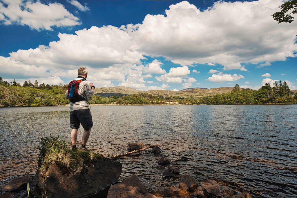
This section of the route takes you across the border and into Tyrone in Northern Ireland via the beautiful Bluestack Mountains and Lough Eske.
Distance: 55km (34 miles)
Difficulty: Moderate. This section offers a mix of rocky, boggy and on-road trails. It can be very boggy and waterlogged in places after heavy rainfall. Although there are some areas that offer a steep climb, they are nowhere near as challenging as the climbs in the Bunglas to Glenties section.
Points of interest:
- Bluestack Mountains: One of Donegal’s many mountain ranges, the Bluestacks offer beautiful views of the Donegal countryside.
- Lough Eske: This beautiful lake is surrounded by the Bluestack Mountains.
Places to stay:
- Heeneys Lodge B&B beside Lough Eske offers a lovely overnight stay.
- If you’re hiking with a group, Meenadreen Cottage, just outside Aughlim, is an excellent option for an overnight stay.
Find out more: Walk NI – Glenties to Killeter
Section 3: Killeter to Gortin
This is where the IAT Ulster-Ireland meets up with the Ulster Way. It is also the most isolated section of the trail with very little civilisation around or spots to pick up refreshments.
Distance: 58km (36 miles)
Difficulty: Easy. Although this is quite a long section, it is relatively easy to hike. This route involves a lot of quiet country roads with the occasional hill walk and forest trails.
Points of interest:
- Bessy Bell: Standing at 473m Bessy Bell is one of eight peaks along the Ulster Way.
- Gortin Glen Forest Park: This is a small forest park made up of five colour coded trails. There are toilets available here also.
Places to stay:
- If you don’t mind heading a bit off trail, The Cedar Country Hotel in Baronscourt is a great option. The hotel has a beautiful garden and delicious breakfast options.
- So tiny, it doesn’t even have a real name, this tiny 1 bedroom loft in Lislap is available for a minimum of two nights.
Find out more: Walk NI – Killeter to Gortin
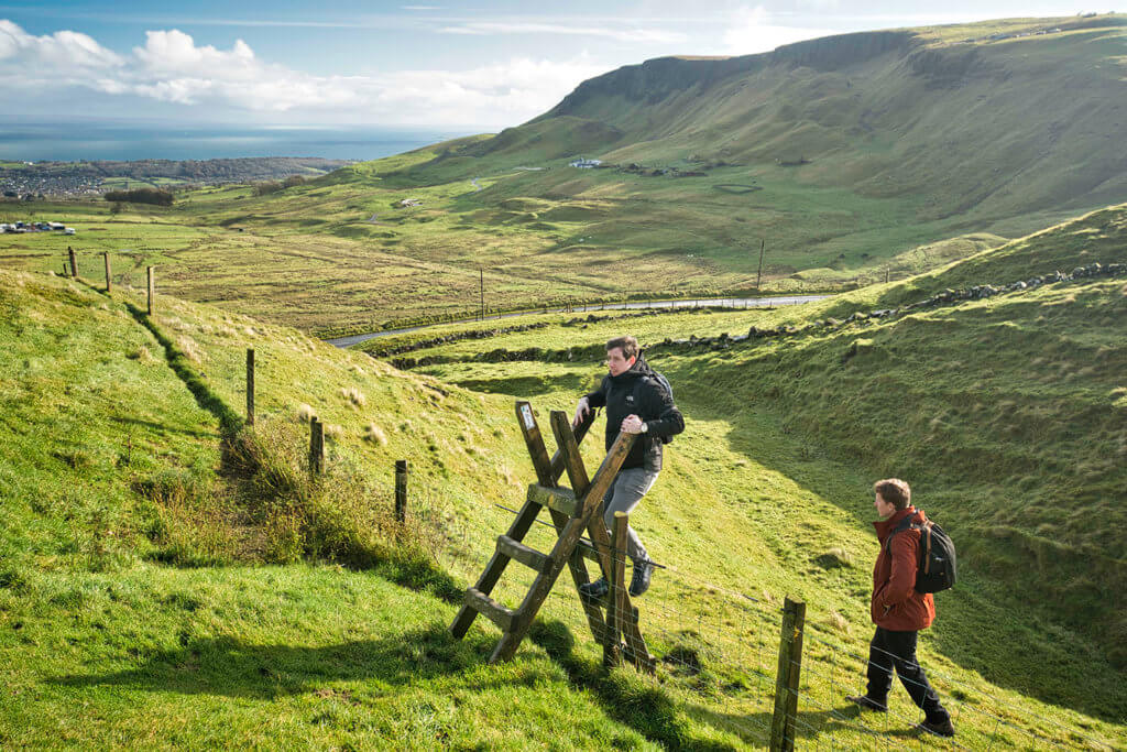
Section 4: Gortin to Moneyneany
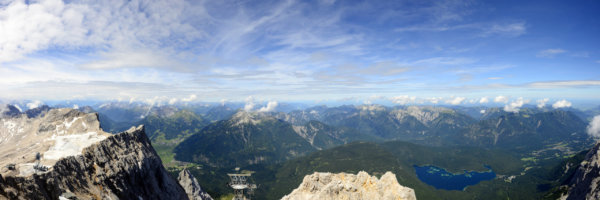
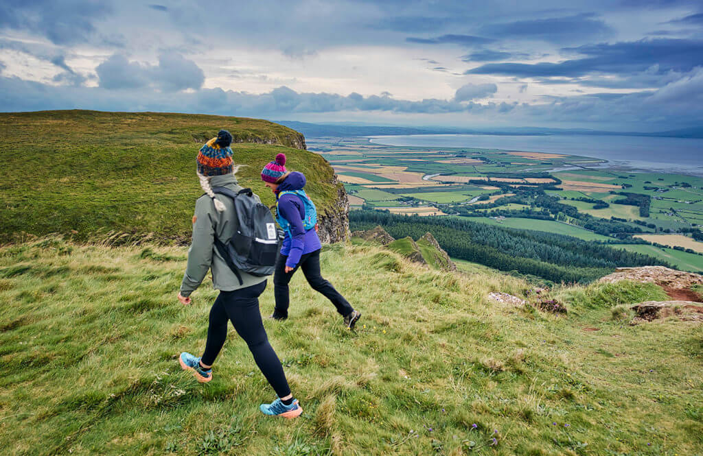
This section brings you through the heart of the Sperrin Mountains which form the largest area of uplands in Northern Ireland. Many people who visit talk about the amazing natural beauty of the area. It truly epitomises the natural beauty of the Irish countryside.
Distance: 37km (23 miles)
Difficulty: Easy. This route will take you through the Sperrin Mountains, but there is very little elevation gain. This is because the route contours along valley slopes. This section also includes a few forest trails and rural roads.
Points of interest:
- The Sperrin Mountains: The Sperrins are virtually untouched even though the offer one of Ireland’s largest upland areas. It is one of Ireland and Northern Ireland’s many hidden gems.
- Barnes Gap: Created from a glacial overflow, Barnes Gap is a beautiful valley through the heart of the Sperrin mountain range.
- Glenelly Valley: Millions of years in the making, this glacial valley showcases some of Northern Ireland’s most dramatic scenery.
Places to stay:
- Again, there aren’t many options for accommodation along this section. Shepards’ Retreat, Omagh, is a good option for a group if you don’t mind going off route temporarily.
- Another option slightly off trail is Whitewater Valley B&B. Just south of Moneyneany it’s the best option for a stop-off at the end of this section.
Find out more: Walk NI – Gortin to Moneyneany
Section 5: Moneyneany to Dungiven
One of the shorter sections, this part takes you through forests and across open hilltops, offering fantastic views of the surrounding area. The rivers and waterfalls in the area are truly breathtaking.
Distance: 21km (13 miles)
Difficulty: Easy. The majority of this section is along rural roads with some forest and open hillside trails.
Points of interest:
- Roe Valley: Roe Valley is breathtakingly beautiful and is renowned for its fishing.
- The Sperrin Mountains: This route takes you up the northern extension of the Sperrins through a crumbling basalt escarpment (perfect for any geology enthusiasts).
Places to stay:
- Hillfoot Caravan Site & Camping in Dungiven offers hikers the opportunity to camp in comfort. Showers and toilets are onsite as well as laundry facilities, a TV room and wifi.
Find out more: Walk NI – Moneyneany to Dungiven
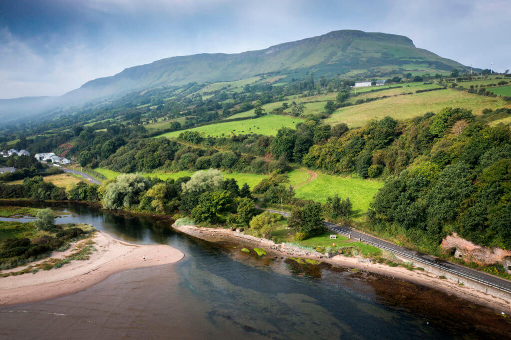
Section 6: Dungiven to Castlerock
This section of the IAT Ulster-Ireland offers a variety of walking, from mountainous and forested trails to quiet flatlands. The North Sperrins Way makes up the majority of this route.
Distance: 60km (37.5 miles)
Difficulty: Easy. Although this is an easy walk for 60km, it follows a lot of roads. Some of these roads can be busy at times. The middle section of this route is the most hiker-friendly. It consists of open moorlands and extensive forest trails.
Points of interest:
- Benbradagh: Standing at 465m, Benbradagh offers beautiful 360-degree views of the surrounding countryside and is the second most northerly summit of the Sperrin mountains.
- Binevenagh: Binevenagh was formed 60 million years ago by molten lava and now offers some of the best views in Northern Ireland. It has a picturesque lake situated at the summit.
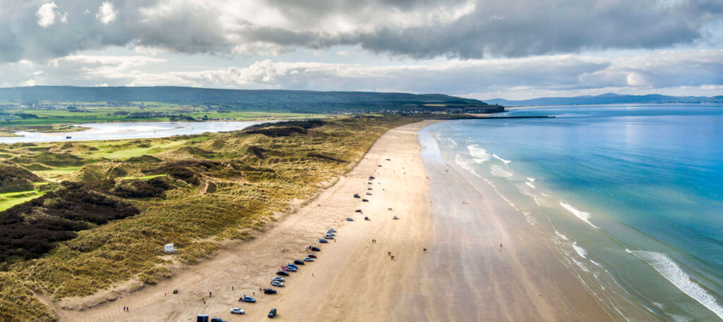
- Downhill Strand: This is one of the most beautiful beaches you will ever see. It is over 11km long and the cliffs at the strand are home to Mussenden Temple. Believe it or not, this round building was constructed as a library and modelled from the Temple of Vesta in the Forum Romanum in Rome.
Places to stay:
- The Gatelodge in Dungiven is a cosy self-catered apartment at the start of this section.
- This apartment in Castlerock, which sleeps two, is right beside the golf course, pub and the beach so you can get a swim in to help your muscles recover.
- The Studio Castlerock comes equipped with a hot tub. What more could you need after a long day of hiking?
Find out more: Walk NI – Dungiven to Castlerock
Section 7: Castlerock to Portstewart
This section acts as a link between the North Sperrins Way and the Causeway Coast Way. It curves around the Bann Estuary to take you into Portstewart.
Distance: 16km (10 miles)
Difficulty: Easy. This route takes you along some main roads and rural roads. The majority of the roads are quiet.
Points of interest:
- Bann Estuary: The Bann Estuary offers nice scenery and there are plenty of places to grab a coffee and a snack along the estuary as you walk.
Places to stay:
- Rambler Travel Inn in Portstewart is one of the cheaper hotels in the area if you are looking for affordability.
- The Anchorage Inn is another affordable hotel in the area and has the award-winning, Anchor Bar attached to it.
Find out more: Walk NI – Castlerock to Portstewart
Section 8: Causeway Coast Way
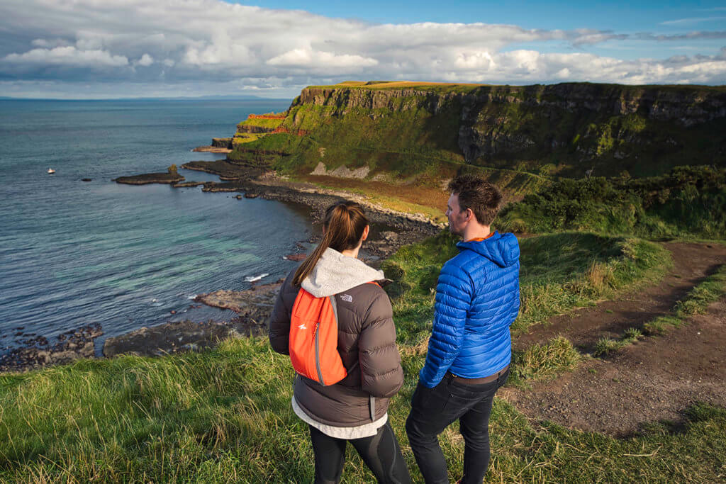
This part of the International Appalachian Trail Ulster-Ireland is arguably the most beautiful. Expect castle ruins, cliffs and even the amazing rock formations of the Giant’s Causeway.
Distance: 52km (33 miles)
Difficulty: Moderate. A fantastic long-distance trail for all abilities, this section offers an easy-to-follow route with a variety of beach walking, rocky trails and some sections on the road. It can be spread out over a few days.
Points of interest:
- Dunluce Castle: Located on the edge of a basalt outcropping, Dunluce Castle is the ruins of a once great medieval castle. Many consider it the most picturesque Irish castle.
- The Giant’s Causeway: The Giant’s Causeway is made up of around 40,000 interlocking basalt columns and is a UNESCO World Heritage Site. It is listed as “an area of global geographical importance”.
- Carrick-a-Rede Rope Bridge: This stunning rope bridge links the mainland to the small island of Carrickarede. The bridge itself is 20 metres long and 30 metres above the rocks below. Would you be able to walk across a rope bridge like that?
Places to stay:
- The Royal Court Hotel is a reasonably priced hotel overlooking White Rocks beach.
- The Causeway Hotel is located on the UNESCO World Heritage site of the Giant’s Causeway.
- The Fullerton Arms is perfectly situated for a stop-off after visiting Carrick-a-Rede as it’s located in Ballintoy Village.
Find out more: Walk NI – Causeway Coast Way
Section 9: Moyle Way

This section passes through a wide range of sights and terrains, including ancient monuments, hill summits and rivers.
Distance: 43km (27 miles)
Difficulty: Hard. This section includes a mix of forest trails, hill walking and upland moorlands. If weather conditions are poor, this section will offer real challenges and hikers will need good navigation skills in these circumstances.
Points of interest:
- Breen Oakwood Nature Reserve: The nature reserve is a haven for wildlife, including many rare birds, red squirrels, newts and dragonflies.
- Glenariff Forest Park: Glenariff, also known as the Queen of the Glens, is one of the nine Glens of Antrim.
Places to stay:
- The Marine Hotel in Ballycastle is located on the seafront and offers spectacular views of the coast.
- 1 Bayview in Glenariff offers cosy accommodation at affordable prices.
Find out more: Walk NI – Moyle Way
Section 10: Waterfoot to Glenarm
This is a ‘link section’ so some walkers may want to skip this section by making use of public transport services, but it is not a necessity.
Distance: 19km (12 miles)
Difficulty: Easy. This section is mostly rural roads, but there are short sections along busy main roads. Unless you are determined to complete the full International Appalachian Trail (IAT) Ulster–Ireland, it is advised that you use public transport services along this section.
Points of interest:
- Garron Point: Garron point is a beautiful location to sit down and grab a snack.
Places to stay:
- The Londonderry Arms Hotel, in the picturesque village of Carnlough, is the perfect spot to set up base for the night along Antrim’s coastline.
- The Curran Court Hotel is an affordable coastal hotel which is ideal for any backpacker.
Find out more: Walk NI – Waterfoot to Glenarm
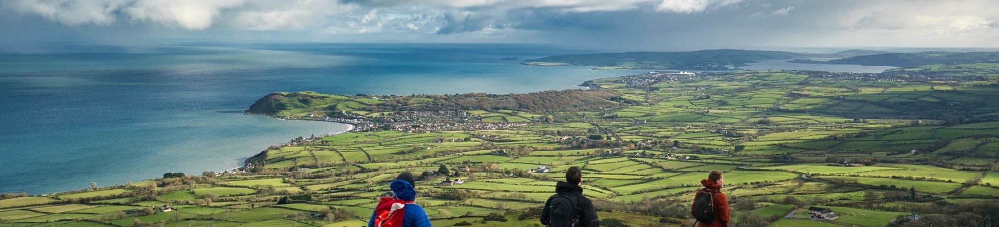
Section 11: Glenarm to Larne
This route showcases some of the most scenic upland areas in the Antrim Glens. As well as the upland areas, you will also be treated to some stunning coastal views.
Distance: 23km (14 miles)
Difficulty: Moderate. The majority of this section is on moorland paths. The upland areas are very exposed, meaning the ground can be extremely soft after periods of rainfall. You will come across the occasional rural road and forest path as well.
Points of interest:
- Glenarm Forest: Glenarm is unknown in comparison to the other eight Glens of Antrim, but it is home to many rare species of trees. This is because of the ideal soil and climate. Glenarm forest is a must-see for any tree enthusiasts.
- Scawt Hill: This is a stunning volcanic plug in Co Antrim. Scawt Hill gets its name from the Ulster Scots ‘scawd’, meaning scaly, scabby or rugged.
- Carnfunnock Country Park: Carnfunnock is 191 hectares of mixed woodlands, colourful gardens and beautiful coastline.
Places to stay:
- The beautiful Ballygally Castle is an ideal place to stay for the final section of the Appalachian Trail.
- Another option is the Halfway House Hotel. Originally built as a coach house in the 1800s, it is now a beautiful seaside hotel.
Find out more: Walk NI – Glenarm to Larne
Camping along the International Appalachian Trail (IAT) Ulster–Ireland
Knowing the rules around wild camping along this trail is very important. Both Ireland and Northern Ireland have different laws when it comes to wild camping. This can create confusion among backpackers who want to embark on Ireland’s section of the International Appalachian Trail.
Camping in Ireland
Wild camping is allowed in some places in Ireland. It is also permitted in some designated spots in our National Parks and Coillte-owned property. These areas are listed here. Remember that most land in Ireland is privately owned, even mountains, so if you seek to wild camp, always ask the landowner’s permission first. The last thing you want is to get kicked out in the middle of the night. And remember to always follow the Leave No Trace code. You are an ambassador for campers and if you leave any mess, you sully the reputation of all campers and hikers.
Find out more: Wild Camping in Ireland
Camping in Northern Ireland
Wild camping without permission is a civil offence in Northern Ireland. While you can’t be arrested for wild camping, a landowner or police officer can ask you to leave and you must leave. Refusing to leave will result in a trespass, which is an arrestable offence. Asking the landowner for permission before you camp is always advisable.
Find out more: Wild Camping in Northern Ireland
To find out more about this amazing trail check out the IAT Ulster-Ireland website. You can also check out the latest news from the trails on the IAT Ulster-Ireland social media channels; Facebook, Instagram and Twitter. You can also post from the trail and see what others are up to by using the #IATUlsterIreland.