Jasper Winn fulfills his long-held ambition of walking the Grand Canal and tells us how his teeth-chatteringly cold winter walk measured up.
What are the dimensions one uses to measure a walk? Distance, of course. Pace, too – whether it’s a leisurely stroll or a sharpish jog. Then – and we’re getting technical now – total ascent and descent. And, of course, the weather. Depending on what the gods throw at you can make a longish march over the hills no more than an amble. Or turn that very same route into a grim trek. Weather is the least predictable dimension when it comes to measuring out walks.
I’ve wanted to walk the Grand Canal Way for years. Wanted to, but being honest, not that much. I liked the idea, of course. A walk of 130km bisecting Ireland, from the coast in Dublin to the Shannon river. In theory I like the stuff that goes with canal walking. No navigation problems given that you’re following a single stretch of water. And no punishing climbs either, with canals by definition taking a line as contour-followingly flat as possible.
But maybe that’s what put me off the Grand Canal Way as well. A spirit-levelled stroll with no navigational challenges, and presumably taken mostly in the company of dog-walkers and puffing //Slí na Sláinte// exercisers. Nah! But then the weather changed everything. In December of 2009 the mercury dropped and then held steady somewhere below freezing, adding that extra dimension to the outdoors. If my walkover challenge might just have become a hard-run race against nature, then it seemed a good time to walk the Grand Canal. And to camp the whole way. Without a tent.
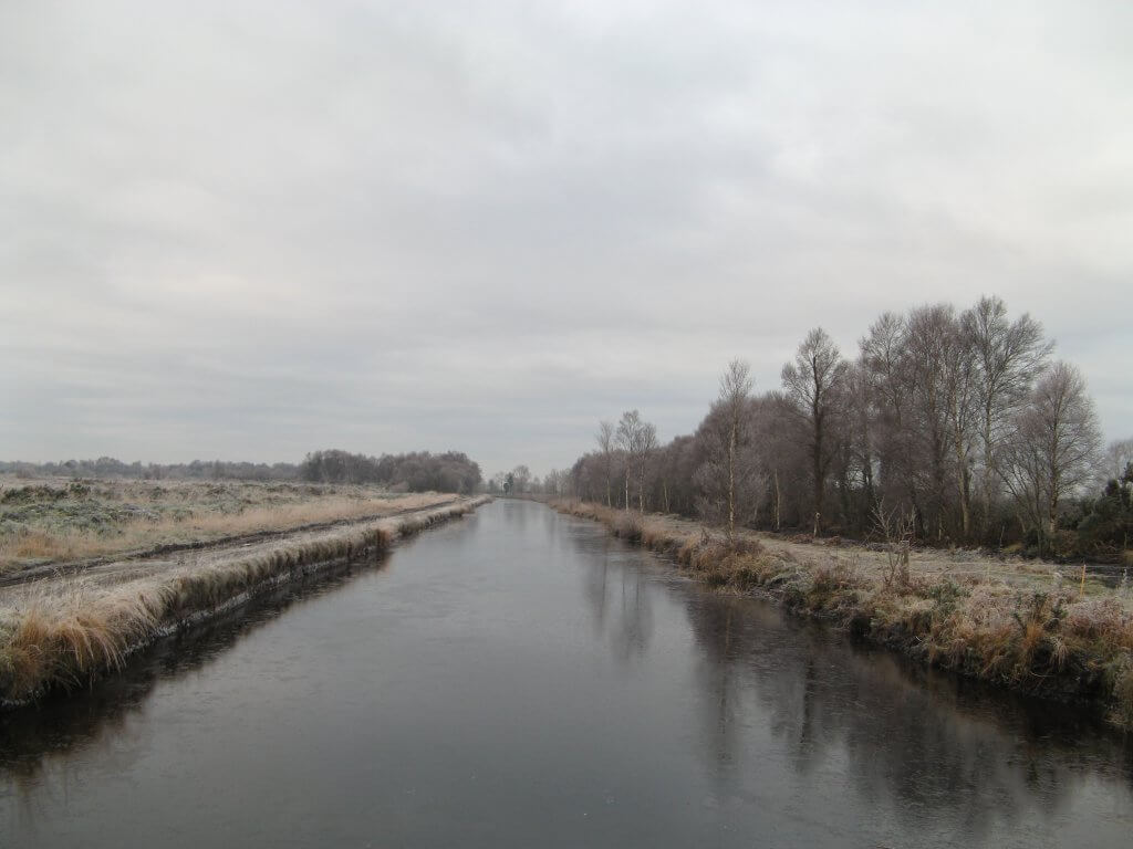
I left from Portobello Bridge in the morning with the kind of hard frost in the air that’s like inhaling alcohol fumes. Ducks, swans and moor-hens were pan-handling for bread along the canal banks.
“With the temperature down around -5ºC I forgot about reaching town and light my stove, brewed up soup and climbed into my sleeping bag. A couple of dog-walkers passed in the dusk as I lay there.”
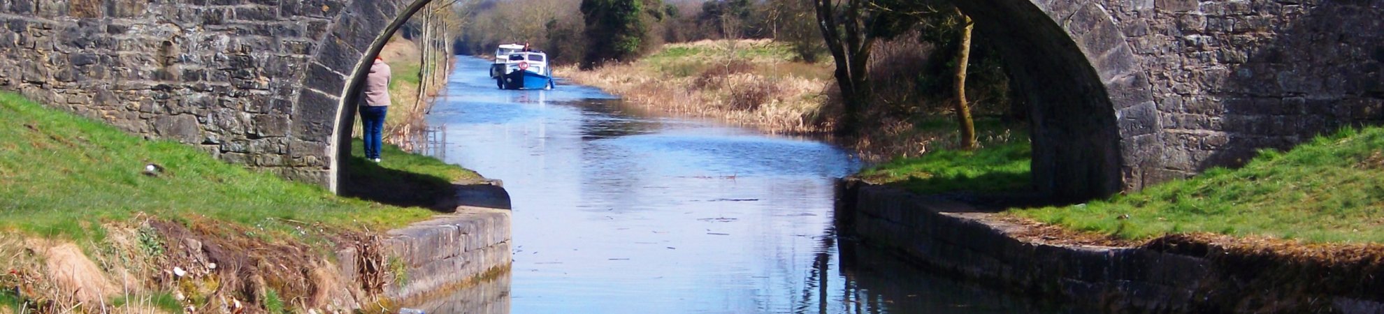
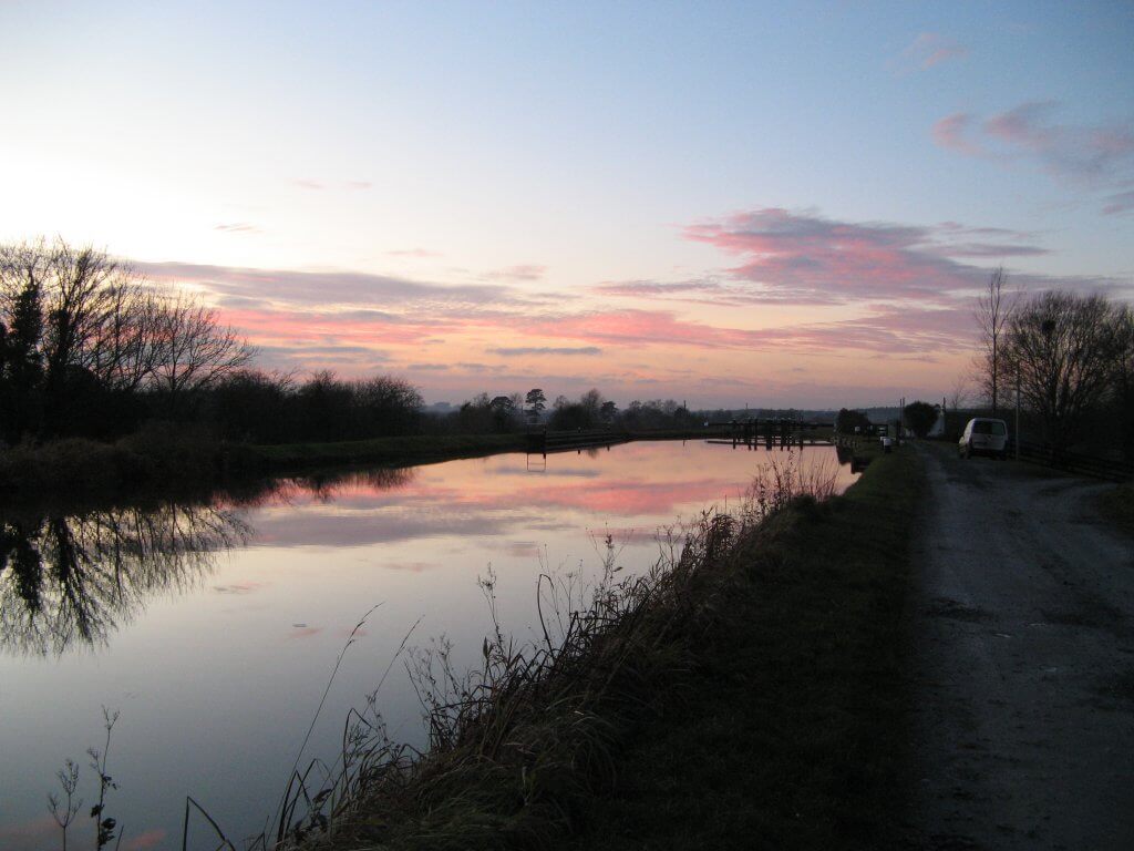
There’s something exciting about walking out of the city and into the wintry countryside. Except when walking along a canal you’re taking the city and the ghost of the industrial revolution with you. Canals are like a piece of giant machinery The Grand Canal was started in 1756 and completed in 1804, when it was used to move heavy loads – mostly peat and barrels of Guinness – across Ireland by barge, and transport passengers in speedy horse-pulled fly-boats that planed over the canal surface like modern speed boats.
To make this watery machine work there was the need for the bridges, aqueducts, locks (there are 43 to raise and lower the water from sea level, over the humped back of Ireland and back to river level), turning-pools and branch canals that were left abandoned when the last CIE barge tied up for good in 1960. I was now walking alongside a forgotten and black watered line across Ireland that’s been left to walkers and fishermen. I nodded greetings at a couple of hardy rodsmen, Poles and Russians, on the bank as I strode towards Sallins and the night.
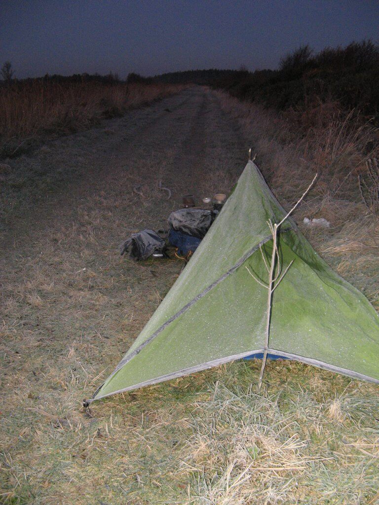
More than the cold it’s the short hours of daylight that were going to be challenging on this trip. It was barely five in the afternoon when I saw a patch of gravel under a blackthorn hedge, part of the tow-path but out of sight. With the temperature down around -5ºC I forgot about reaching town and light my stove, brewed up soup and climbed into my sleeping bag. A couple of dog-walkers passed in the dusk as I lay there. And then a shaky light as a cyclist bucked and juddered over the frozen mud ruts. No one noticed me. When I woke much later, the night was clear, star-sparked and very cold.
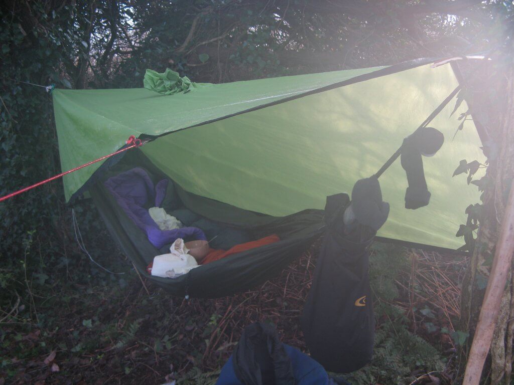
“At one point in the night I woke and touched the light tarp I’d stretched over me; it crackled like greaseproof paper. It and everything else was crisped with ice.”
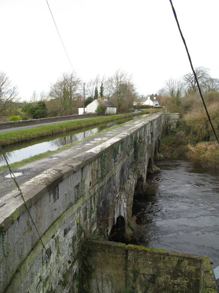
I started well before light. Striking camp in minutes, eating oat biscuits as I walked, watching the dawn come up, stamping my feet to warm them. The live-aboard barges before Sallins had smoke coming out of their chimneys, and the Canal Walk Café on the quay was open. The big breakfast was a chance to warm up. The day outside when I left was sunny but not warm. A fast morning’s walk led me along dead straight roads, past farms and houses and at one point across the aqueduct which carried the canal over the Liffey river winding far below.
By mid-afternoon I was heading into the Bog of Allen. As I walked further along the tow-path, the only signs of human endeavour amongst the scrubby flattened landscape and the peat hags were the lifting-bridges like gallows and the canal itself. The lack of trees meant bivouacking on the ground. By six I was in my sleeping-bag, fully dressed. At one point in the night I woke and touched the light tarp I’d stretched over me; it crackled like greaseproof paper. It and everything else was crisped with ice.
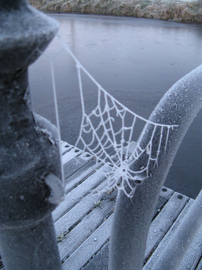
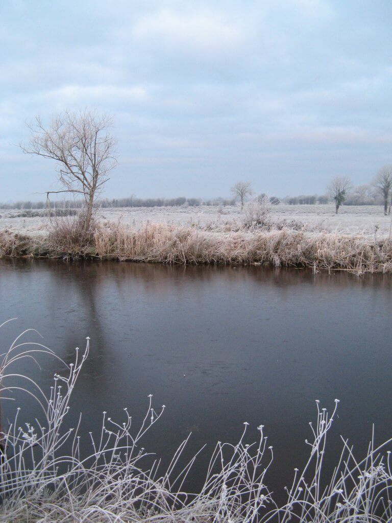
The next morning my hands were almost too cold to light the stove and brew up coffee and heat some porridge. The tow-path ahead of me was frost-silvered in the rising sun, and there was a skin of ice on the canal water. Walking on I recalled accounts of the gangs of men labouring through 10 winters with shovels to raise the foundations and high banks and the broad path that formed the canal’s progress across the unstable bog below me.
“In the frost the next morning I could see the tracks of deer and fox in the short grass. There were frozen splashes of water where an otter had shattered the ice-skin between land and water.”
Two nights of sleeping out was taking its toll and the third day’s walking passed in just doing the miles. With no navigation challenges there was little to think of, except where to pass that night. The temperature had dropped a few more degrees during the day and with dusk fell even more. In the late afternoon I burrowed deep into a tangle of trees to find a place to swing my hammock. My hands were too cold to get the stove lit and I feasted on oat biscuits and cheese. I was using all the tricks I could remember to conserve heat. More insulation under me than over me; no clothing that was too tight; using my rucksack as a foot bag; drinking more water than my thirst suggested.
In the frost the next morning I could see the tracks of deer and fox in the short grass. There were frozen splashes of water where an otter had shattered the ice-skin between land and water. Daingean, reached on Sunday lunchtime, came at just the right moment. A full breakfast, slowly warming up, and a pint to ready me for the road. And best of all some encouragement. A couple eating at the next table saw my boots and rucksack. “Isn’t the Canal Way great,” they enthused? The woman was a keen runner, and told me that there had been an annual long-distance race along the tow-path at one time. They sounded regretful that they weren’t joining me for the next stage to Tullamore.
The pace and sleeping out is telling. The first day I’d done just under 20 miles, and day before I’d done 24 miles, but this day I’ve struggled to do 15. There are still more than 20 to reach the Shannon. I walked on in the dark, past Shra Castle and the graveyard and then camp in a hole in the hedge. The hammock’s value is being able to sleep comfortably anywhere there are two trees, swinging clear of the damp and rough ground below.
The next morning I break camp around six, hours before dawn, walking along the tow-path by the light of the head-torch, my balaclava on. As it becomes light I see that the canal water is fully frozen and everything is white. It’s startlingly beautiful, changing Ireland’s landscape as I think I know it, so it becomes something more exotic and ‘elsewhere’. At one point I flag down a woman passing in a car to ask how far it is to Shannonbridge. She tells me, though seems a little wary of me. It’s only later that I realise that apart from only having my eyes showing through my ski mask, I’ve left my head torch on and was blinding her with its beam.
I’ve blinded myself to something fairly obvious, as well. Walking hard all day I’ve passed growing numbers of small roads crossing the canal on bridges leading to small villages, showing that I’m out of the Midland’s boggy wilderness and approaching the Shannon River. Keeping the pace up I come into Shannonbridge all of a sudden. Big abandoned warehouses line the quays and pleasure cruises are tied up. I feel a brief burst of satisfaction. I’ve done 130km and it’s certainly been given an extra dimension by the frost and the four nights of cold-weather bivouacking. But I haven’t thought about how I’ll get back to Dublin or out of Shannonbridge at all. On a mid-winter’s afternoon there’s no bus out. And dead-ended on the Shannon’s shore, there’s rarely through traffic passing the village that might give me a lift.
Apparently I’d found another dimension, beyond distance, and pace, and total ascent, and even weather when it came to measuring out a walk. And that’s how to get back to where I’d started from when I’d finished walking.
If you are interested in walking the Grand Canal Way like Jasper, here is some extra information:
The Grand Canal Way is an official way-marked trail, running 130km between Ringsend in Dublin and Shannonbridge. Information on the route, and accommodation possibilities on or close to the way, is available from walks.iwai.ie/grand
Maps
Ordnance Survey of Ireland, Discovery Series 1:50,000
– Map 53 – from Shannon Harbour to near L’estrange bridge
– Map 47 – from L’estrange bridge to Ferbane
– Map 48 – from west of Derry Bridge to east of Daingean
– Map 49 – from west of Rhode bridge to 15th Lock
– Map 50 – from east of 15th lock to Dublin
– Map 55 – Milltown Feeder from south of Hill of Allen to Pollardstown Fen
There is a 22-mile stretch across the Bog of Allen which doesn’t pass directly through any towns or villages meaning no shops and no bars without striking away from the canal in some cases for a considerable distance.
Check out our Hard as Nails podcast:
Keep for some winter walking in Ireland? Take a look at the links below:
- 10 of the Best Irish Walking Routes
- 4 Short Walks in Ireland for Winter Days
- The Water Diaries: Fearghal O’Nuallain’s Journey along the Indus River