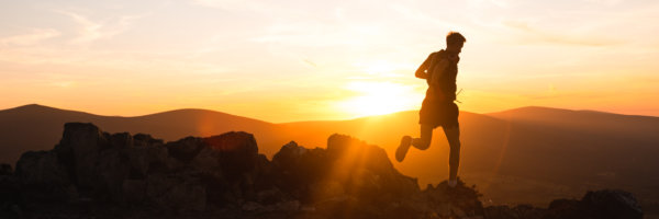
Winter Hiking: The Essential Info
Before we jump into our list of 6 must do hikes in Ulster, there are a few things to bear in mind when it comes to hiking in Ireland in the winter:
Weather Conditions – If it is going to be treacherous you would be better off playing it safe and staying low.
Daylight – Winter days in Ireland are definitely long enough to get a good hike done in daylight hours, however, if you are running behind schedule you may want to change your route to an easily navigated route.
Changeable conditions – As all outdoor enthusiasts know the weather can change unexpectedly, especially on the hills. For this reason, in some of the routes below we will suggest an alternative route which will be an easy way back to your car if the weather deteriorates or if night falls. These should not be relied upon but are good peace of mind.
We have included links to the routes discussed for the must-do hikes and climbs below. If you are not confident using a GPS device or a map and compass we would advise sticking to the “Walk, family-friendly walk, or favourite forest” recommendations.
6 of the best winter walks in Ulster:
1. A hike
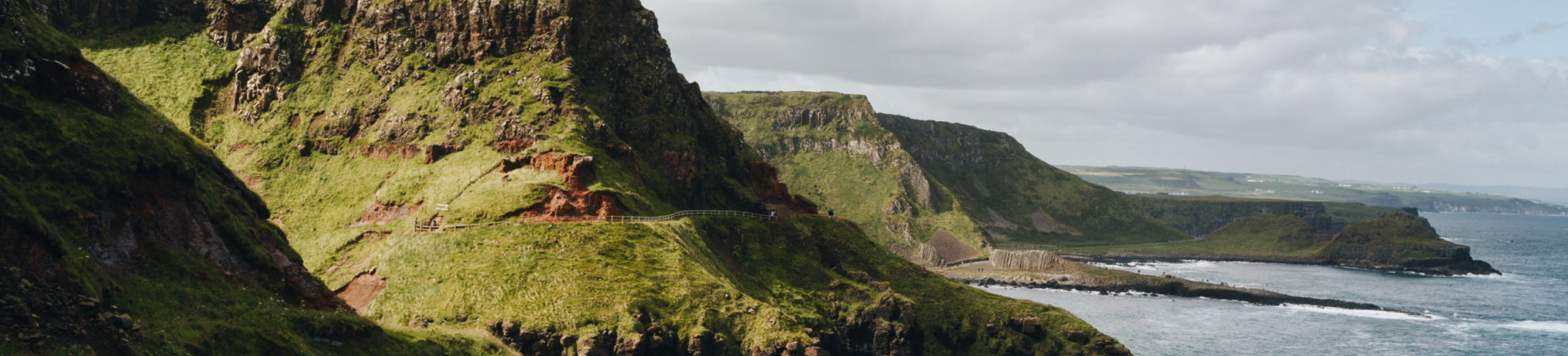
The Causeway Coast Way
Distance: 50km (allow 2-3 days)
View this post on Instagram
Back in 2018 Outsider, Matthew, did the Causeway Coast Way solo and was blown away by the incredible coastal cliffs and beautiful views. The causeway coast way is a 50km waymarked trail between Portrush and Ballycastle in Northern Ireland. The route provides some stunning views of the Irish coastline including long sandy beaches, dramatic sea cliffs and of course the impressive Giant’s Causeway. Matthew did the hike spread over 2 days but it could be done spread over 3 if you wanted to take your time with it. Here are some thoughts Matthew had on the route;
“What a stunning hike! I did it during the summer back in 2018, at the time it was one of my first solo overnight hiking trips. There are a few options for accommodation, I decided to stay in the Finn McCool youth hostel which is only about 5 minute’s walk from the Giant’s Causeway. I would perhaps recommend that you skip the last section from the Carrick-a-Rede rope bridge to Ballycastle as that is a 8km road section that is definitely not as exciting as the miles that preceded them! My favourite section was the 20km section from Portballintrae to the Carrick-a-Rede rope bridge with a special shoutout to White Park Bay, an almost 3km stretch along a stunning sandy beach!”
2. A climb
Errigal
Distance: 4km (allow 2-3 hours)
View this post on Instagram
Standing 751 meters tall, the highest peak in Donegal is Errigal. An impressive, challenging mountain that demands good footwear and good weather. A simple but by no means easy up and back route is the best way to go with Errigal. The “short” 2 kilometer climb from the carpark is tough, but manageable for nearly all hikers. The peak offers great views over the rest of the Derryveagh Mountains to the north east as well as great views over the Glenveagh National Park to the east.
3. A walk
Ards Forest
Distance: Varied
View this post on Instagram
Ards Forest Park is a great spot for a walk or hike at any time of year! This forest covers and impressive 1200 acres and a large variety of habitats. Beaches, salt marshes, sand dunes and of course beautiful deciduous and coniferous woodland. You can simply wander around the forest or you can pick one of the many routes coillte have designed. Or, by “stitching together” a number of trails, it is possible to hike for 5/6 hours on forest tracks and trails, taking in the full circuit of the park”
Also “For those interested in human history, there are a number of historical and archaeological features. There are the remains of four ring forts together with a holy well and a mass rock.” Credit – Coillte.ie
Ards forest park offers a great bad weather alternative to a hike in the nearby mountains. Located a short 20 minute drive from both Errigal and Muckish.
4. A family friendly walk
Tollymore Forest Park
Distance: Varied
View this post on Instagram
Located at the foot of the Mourne Mountains, Tollymore Forest Park spans across a vast area of 630 hectares filled with rolling valleys, dribbling streams and lush forest. The entire park offers panoramic views of the Mourne Mountains and the sea at Newcastle and was one of the locations used in Game of Thrones.
Tollymore is yet another brilliant bad weather day walking alternative to the nearby Mourne mountains.
10 Exhilarating Activities Along the Mourne Coastal Route
5. Favourite Forest
Castlewellan Forest
Distance: Varied
View this post on Instagram
Castlewellan Forest Park covers 450 hectares of stunning land just north of the majestic Mourne Mountains. From the shimmering waters of Castlewellan Lake to the sturdy walls of a towering Victorian Castle, this park offers incredible, panoramic views of the Mourne Mountains that can be enjoyed while participating in a plethora of fun activities. As well as offering hours worth of walking trails. Castlewellan is also well known for its 27km of mountain bike specific trails. If you are walking here heed the advice of the signs and do not walk on the mountain bike trails!
Our guide to Mountain biking centres in Ireland
6. Honourable mention
Slieve League
Distance: 12km (allow 4-5 hours)
View this post on Instagram
Slieve League is a mountain that stands at a height of 596 meters, it has the second-highest sea cliffs in Ireland after Croaghaun (which we included in our Connaught guide), and some of the highest sea cliffs in Europe. The cliffs are quite exposed and thus this route should not be attempted if the weather is not playing ball.